- The Human Impact of IBR Property Takings

The Planned SR 500 Interchange, with the first half of that new Braided Off Ramp.
Did you know that we are still demolishing houses and businesses to make way for more lanes on freeways? Like, this year. 2024. You might have heard stories of Houston, where as many as 1000 people may be displaced by widening of I-45 [1], or Austin, where 111 households will have to move [2]. These kinds of projects would never have been greenlit in a blue state, right? Wrong. The IBR Project, a $5 Billion freeway expansion inexorably grafted onto a $2 Billion Bridge Replacement [3], is planning on displacing at least 76 Washington & Oregon homes in the name of… more cars traveling from Portland’s northern exurbs into its center city. Priorities, I guess?!?
In the Environmental Impact Statement (“Property Acquisitions and Displacements” report) for this project, IBR asserts that these impacts are actually quite modest:
“The real estate acquisitions required for the Modified LPA are high in the context of other recent actions in this vicinity, but they are relatively low for a project of this size located in an already urbanized area…There would be few residential displacements in neighborhoods that were directly affected by the original construction of I-5…For example, when the segment of I-5 known as the Minnesota Freeway was constructed from the Rose Garden area to the Columbia River Slough in northeast Portland, it removed more than 180 dwellings and displaced more than 400 residents (Kramer 2004).”
Only disrupting “new” neighborhoods, and not the original ones affected by I-5 is an odd metric of success if you ask me. If the bar for progress is displacing 150 residents rather than 400, then I think its time we question the very premise here. How necessary is the of demolishing any homes for a project that we know will waste Billions of dollars, blight the Vancouver and Hayden Island waterfronts, pollute the air we breathe, and not even solve traffic? Surely those billions could be better spent on literally anything else. [4] [5] [6]
ODOT/WSDOT knows how unsavory mass displacement is, and so the Environmental Impact Statement is very careful to obscure the human impact of this project. Documents like the Draft EIS are far from impartial; they are written BY the agencies who proposed the project in the first place (and hold close relationships with Contractor Firms who stand to profit on projects like these getting approved)! When reading a planning document, remember to always read between the lines. Ask yourself: Who stands to benefit from a project like this getting approved? What perspectives may the document lack? Is the document trying to draw my attention to, or away from any topic? Anyway, lets move on to the actual Property Acquisition Map:
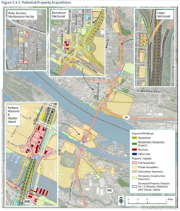
It’s easy to lose focus on a map like this. Let’s break it down: Partial Acquisitions of land—often big, largely uninhabited parcels (like Delta Park, Jantzen Beach Shopping Center, and Fort Vancouver) are colored a pale yellow, and the entire lot is generally highlighted, even when the acquisitions are marginal. The same could be said about the Temporary Construction Easements (generally, permits to park equipment, site construction materials, and subject residents to construction noise), which are colored a pale green. These blow out the map with relatively modest impacts–“temporary” and “partial” frame the project as pretty benign. Only once we begin to zoom in do we notice the parcels marked for Full Acquisition, highlighted with a red border. Businesses acquired are outlined a bold red, drawing attention to them, and Temporary Residential Impacts are outlined in a bold green (y’know, for when your HOUSE is only going to be MOVED temporarily). Lastly, Residential Impacts are outlined with a solid yellow, seamlessly blending into the sea of Partial Acquisitions… wait, what were we talking about? Oh yeah, each “Residential Impact” is a house that will no longer exist once this project is done. Not to Bury the Lede, IBR! Lets get counting, from the southern terminus of the project:
- IBR counts 4 displaced homes on mainland Oregon and 5 businesses. The homes are all west of current I-5 on the waterfront, and the businesses can be found on both sides.
- IBR counts 32 outright Displacements of floating homes on Hayden Island. We both count 6 floating homes “temporarily displaced” on Hayden Island. Note the 20-something floating homes outside of the “Temporary Construction Easement” zone but not listed as “Temporary Displacements”. We both count 14 businesses displaced on Hayden Island; everything between Center Ave & I-5 will be gone, as well as JayBees Chicken Palace.

- IBR Counts 10 businesses demolished in Downtown Vancouver. These are all either in the Hurley Building, a 6-story office building constructed in 2019, or an office park across the street from Hurley.
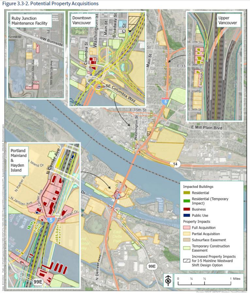
- Normandy Apartments, a 33-unit apartment building, *may* be demolished, along with the Regal City Center movie theater building, provided IBR pursues the “Westward Shift” option. The Westward Shift would build the new bridges parallel to the existing ones, and this option seems likely to me. If you couldn’t tell from the map, I don’t blame you; the potential eviction of dozens is represented by a hatched grey box around a yellow parcel bubble. The Columbia Credit Union building and/or the Webber Office Building may also be demolished for a parking structure, to be determined.

- I count 5 outright home demolitions + a residential duplex demolition, and 17 “partial acquisitions” of residences between SR 500 and 4th Plain Boulevard. All of this for a “Braided Off-Ramp” that starts somewhere north of E 40th St and continues almost a full mile south to E 26th St. I may not be a traffic engineer, but this design choice feels especially strange to me. Most freeway offramps do not last a mile, to my knowledge!


By IBR’s estimates, this totals 76 homes displaced outright, 33 Businesses, and 2 Public Facilities (An ODOT permitting office on Hayden Island and a Clark Public Utilities building on the Vancouver Waterfront). The partial acquisitions are more subjective and the project refuses to go into more detail on most of them, but I would assume that some partial acquisitions between SR 500 and 4th Plain Blvd will eventually result in the condemnation of a house. The impacts are also subject to change: If you want to look more closely at the land acquisitions for this project, I recommend checking out my public Google Maps project cataloging all of them. If something seems wrong, it might be; I’m working from the same single low-res image above.
Note: this blog was only about the “Permanent acquisitions”, or buildings which would literally be demolished or moved. In a future blog post, I will be digging deeper into the Partial Impacts. Just because your house wasn’t demolished doesn’t mean your yard, your trees, your business or your peace of mind will be spared. Stay tuned!
[1] www.texastribune.org/2023/03/07/houston-interstate-45-highway-expansion/
[2] www.kut.org/transportation/2023-10-16/austin-i-35-expansion-displacements
[3] cityobservatory.org/why-does-a-500-million-bridge-replacement-cost-7-5-billion/
[4] www.opb.org/article/2023/12/01/explaining-oregon-school-funding-challenges-taxes/
- What About the Fish?

The Columbia River is of course migratory habitat for endangered species including Salmon and Steelhead, so construction of the IBR has to be sensitive to these issues.
Among the permitting agencies, the U.S. Army Corps of Engineers publishes as standard in-water work window of November to February. The IBR project however has argued that this would unjustifiably lengthen the number of years required for construction. A Biological Assessment published last year suggests the project would seasonably restrict some activities:

But the same document proposes no restrictions on other activities:

Of particular interest are vibratory hammers and oscillators. ODOT is currently using oscillators to drive pilings for the Abernethy Bridge on I-205 at Oregon City. Interestingly, the Army Corps only appears to be allowing use of oscillators on the Abernethy from July 1 to December 31.
Why are the fish in the Columbia deserving of less protection? Will the Army Corps issue IBR a permit for year-round use of oscillators and vibratory hammers?
- The Public Comment Period is Coming!
The public comment period for the Supplemental Draft EIS will likely begin within a month or two. The Alliance is creating resources to help you understand and meaningfully comment. You can find resources in our library (including draft review copies of some EIS files) as well as an ongoing series of insights from Alliance members.
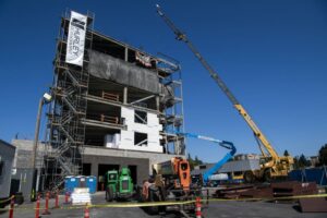
- RIP Hurley Building (2020-202?)
Among the pre-release files that the Alliance has obtained via public records request is a draft report on the bridge design options: double-deck, single-deck or lift.
An interesting line the “Land Use” line in the comparison table:
Would displace the Hurley Building (commercial office use) in
Vancouver.That’s true for all three options. What’s interesting is that the Hurley Building is brand new, just completed in 2020. It’s a six-story office condominium project.
Here is coverage in The Columbian while the project was under construction. It includes this fateful quote:
“This particular site is located outside of the last set of concept designs shown for the bridge,” Hurley said. “We don’t expect the building to impact any future plans of a bridge.”
Oops…